with the risc of writing a ‘dumb post’, but… could you elaborate a bit? I don’t get what you are trying to bring across…
There are many ideas about how the contributors could work more efficiently.
My greatest displeasure is the error in the Osmand plugin.
But I told that before.
Could you share a link to that?
Is this what you’re looking for, @filipc? To have this work?
Map viewing[edit]
- Display the position and orientation on the map
- Optionally align the map according to compass or the direction of motion of the device
- Places can be saved as favorites
- Display POIs (point of interests)
- Can display online tile maps
- Can display satellite view (from Bing)
- Can display different overlays like touring/navigation GPX tracks and additional maps with customizable transparency
- Optionally display place names in English, local, or phonetic spelling
** With the Mapillary layer enabled (built-in plugin), view user-submitted street view images, play photo sequences[5]*
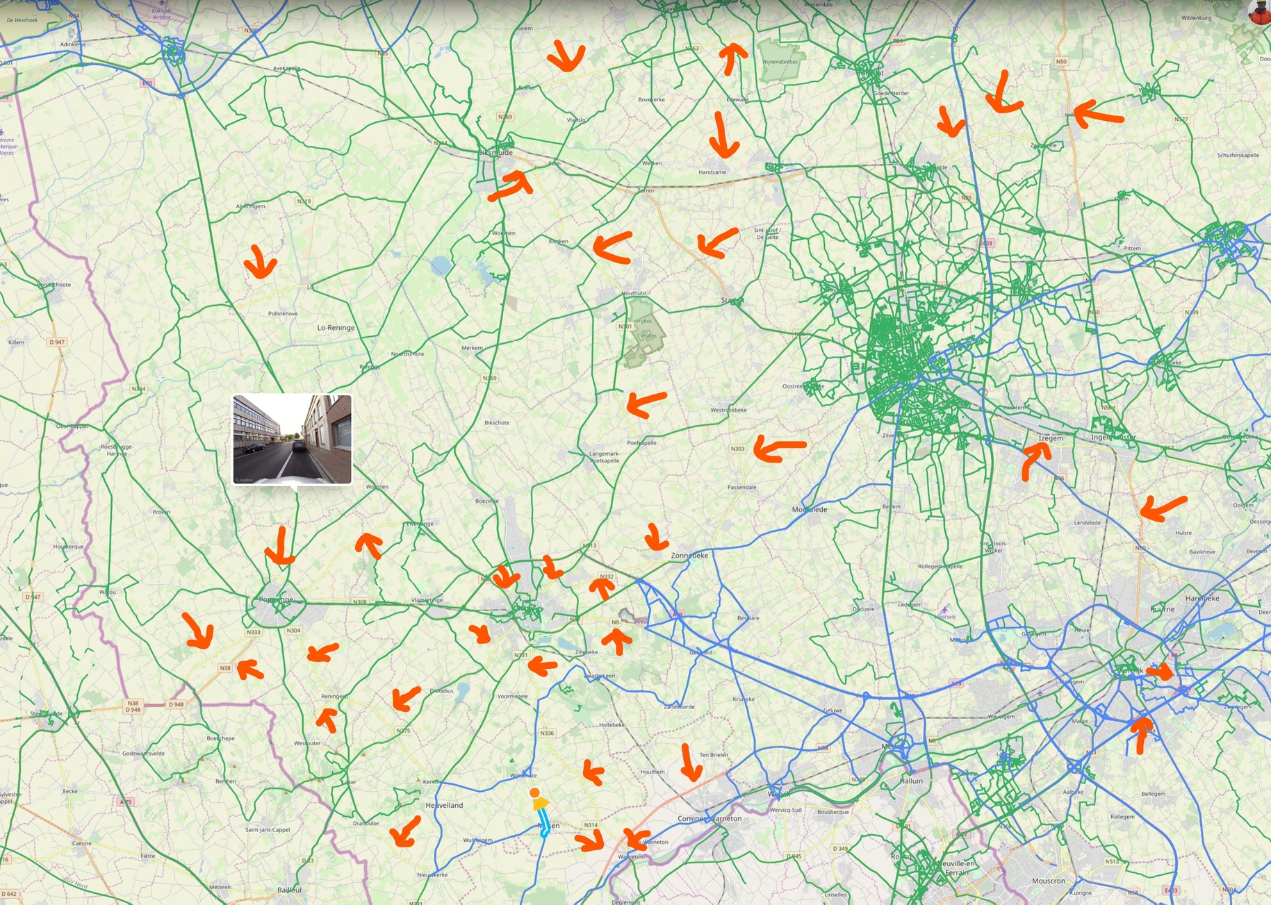
Hey I know that region… (most of my own photo’s are within this frame…).
I have to say, I’m not entirely sure how you use that data to work with either, so I’ll agree on it being ‘primitive’.
So much open space there, it’s harder to take roads that have footage rather then are short on footage.
I plan on ‘completing’ the built-up area for Lichtervelde, Meulebeke, Wielsbeke and Ingelmunster myself, and maybe work a bit on Izegem/Staden eventually. Trying to combine it with actually having a reason to be there though ![]()
I am now completing the red and yellow roads in Flanders.
It will be comfortable for a mapper to know that those roads are covered at least to some degree.
You will have to hurry, I plan to do the remaining in your region this weekend.
I
Oh that’s fine. I go for those when I actually NEED them, other then that I prefer to go for the smaller roads, as they are less likely to get coverage by others.
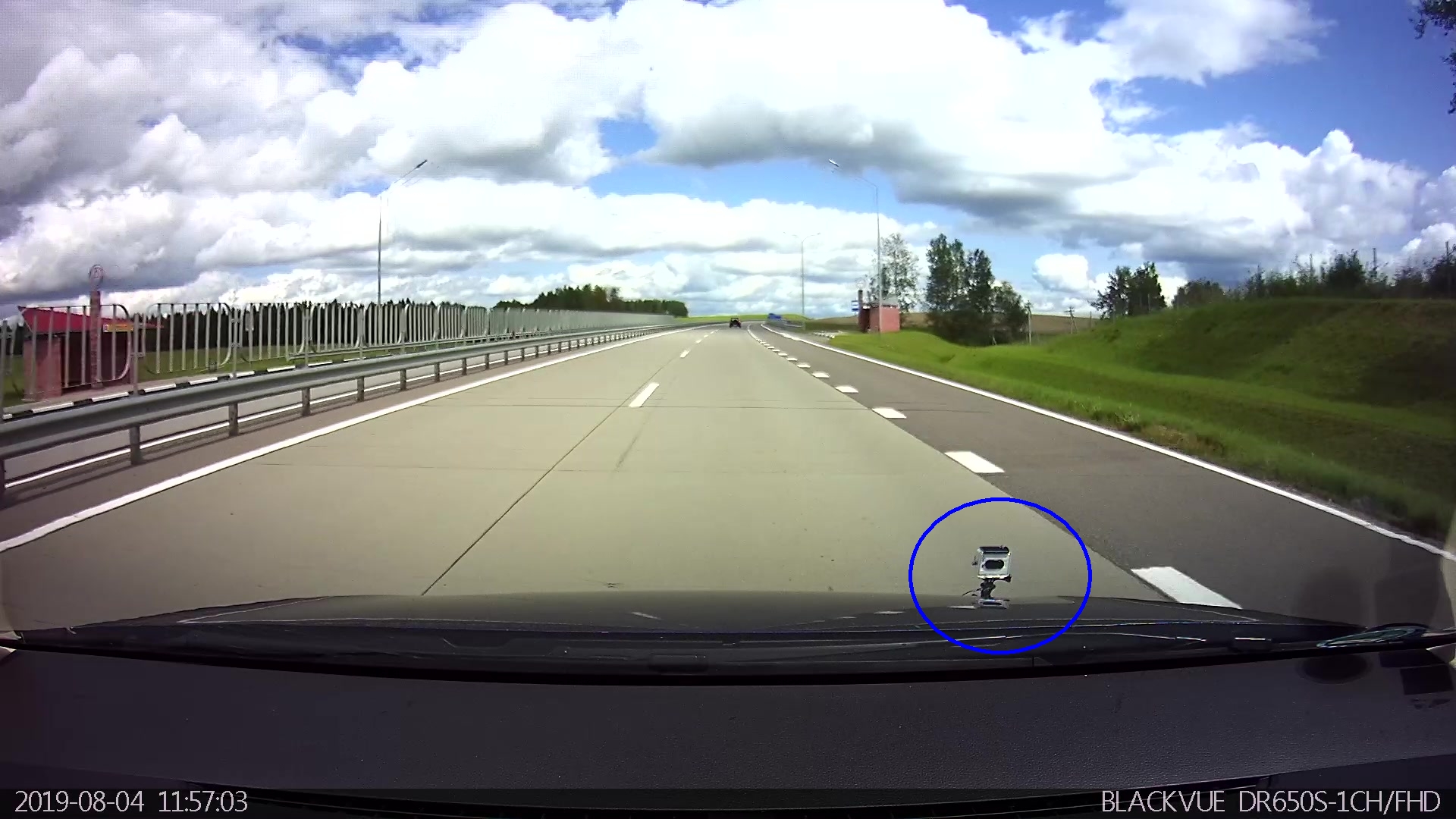
Actually using a GoPro on a bike now aswell, to fill in the paths I couldn’t do by car or where I’m missing stuff.
It is perfectly possible to use your Gopro in the car. It is not so hard to operate the shutter before you start or after you stopped.
And the mappers will thank you for it.
Not found a way to properly mount it, so I can shoot imagery at wide angle, without it showing too much dashboard…
Will probably look into that further, getting spare batteries for the GoPro too. Not had it for too long, and I basically am using that as an excuse to bike around more… ![]()
This mount without the arm works for me.
https://gopro.com/en/be/shop/mounts/suction-cup/AUCMT-302.html
the only way to do it without dashboard (and occasional reflections) in sight - is to mount it outside.
This is easy with a use of suction cup mounts.
I mount mine close to the edge of the hood
The selection of suction mounts is huge, from my own experience, paying 50$ for the original mounts does NOT make any sense, I’m using 1.7$ mount fro Aliexpress and so far - I’m fully satisfied.
I was driving on highways with the speeds up to 150 kph - it has never went off (have driven 2600 km with it already).
The only precaution - use a safety strap, suction cups may go off during rain
On top you will need a long 2m USB charging cable if you want to have it connected to AC rather than running on batteries.
Downsides: you may catch the bug in the lens if driving above 80-90 kph and you will not spot it timely unless you will be controlling what you shoot via app/wi-fi. Thanks tot the small size of the lens, the likelihood of such an event is not very high, this happened to me only once so far.
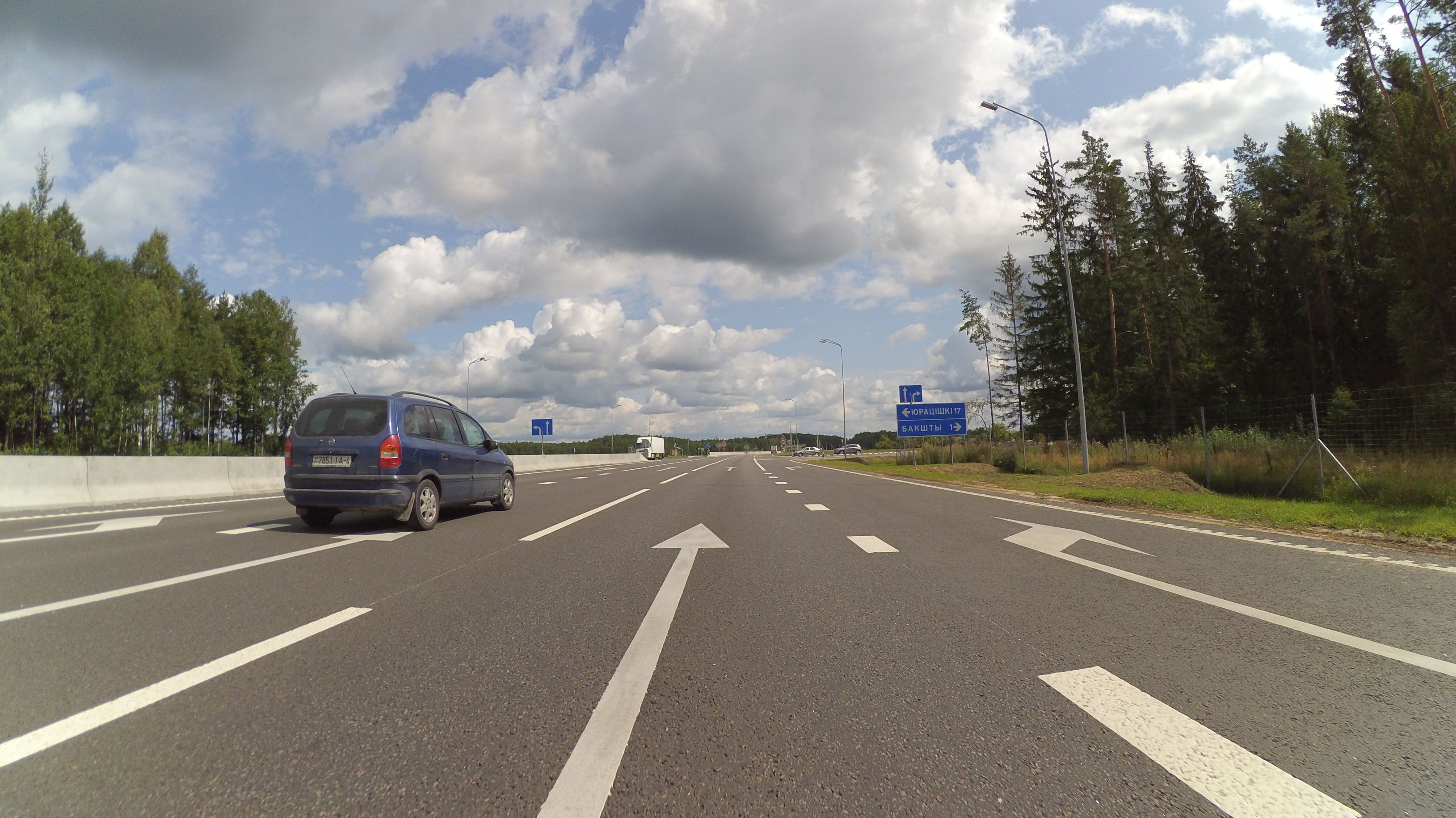
If you want, you can go for 3-point suction mounts like this
How it looks:
Mount with camera:
Sample shot:
p.s. If you prefer shooting from inside - you may use various software tools to crop your images in a batch (I personally use IrfanView for simple batch processing like crop, resize, rename, conversion, etc.)
Maybe you want to use this: https://geoclub.de/mapillary/mapradar.html
Take a tablet or notebook with GPS and you can see which roads are still open to capture.
This is really cool. Would be better if it rendered the directions too so we could do sideways images, but still very useful.
The android mappillary app explore has brolems loading osm tiles.
It also does not follow the location.
Yes, this is better.
If only the osmand plugin showed all sequences at all zoom levels.
And in osmand I can have my overpass results (indirectly).
With regards to MapRadar, I find that BRouter is even more useful.
- Open http://brouter.de/brouter-web/
- Click on the Layers icon and then on “Add custom layer”
- Call the layer Mapillary and set the URL to:
https://d6a1v2w10ny40.cloudfront.net/v0.1/{z}/{x}/{y}.png - Click on “Add a stackable layer”
- Close the dialog and check the Mapillary layer.
- Start planning a trip that avoids all the green roads

All majors roads have been visited, now I want to
visit the
node[“emergency”=“defibrillator”][“indoor”!=“yes”][“access”!=“private”][!“mapillary”]
avoiding
green roads.
I also need a date filter.
It is time that Mapillary makes itself useful for real work.
Or could that be done in JOSM ?
You may want to create an organization account and use the Mapillary project tools for your own use.
Have you ? I tried. It only makes squares to assign to drivers. For the rest it is of no use.