I am really impressed at the ability of Mapillary to create signs and other point features. I have a bunch of questions and hope you all on the forum can help.
-
Is it normal for map data (signs and points) to be generated randomly and very slowly? I have some captures a couple of weeks old with no points produced (example). Then I have more recent captures with a patchwork of points.
-
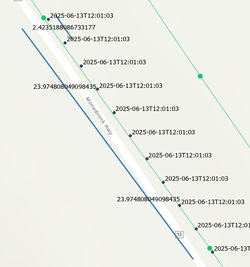
I have noticed that the GPS tracks from my X5 are stored with 10 points per second. However, when they come into Mapillary, there is 1 point per second. This seems to lead to fewer photos published and I wonder if this is compromising creation of map data like signs and points? In the photo below the blue line is my track, the black dots are the .gpx provided with the video upload, and the green line is someone else’s track.

There seems to be no information about units of time less than a second in the data. Does this mean it is a feature request to Insta360? Is there a way Mapillary could just guess at the times to enable more points to come in? Do other GPS loggers output files with more resolution? It just seems like a waste to capture at 30fps but end up with 1fps!