My first impressions of Mapillary (Day 12)

Hi, I’m new here and would like to share some things that make me scratch my head, They maybe has been addressed in forum elsewhere but I haven’t found them.

My setup, GoPro Max 2, Android App, Windows Uploader, Chrome Browser.

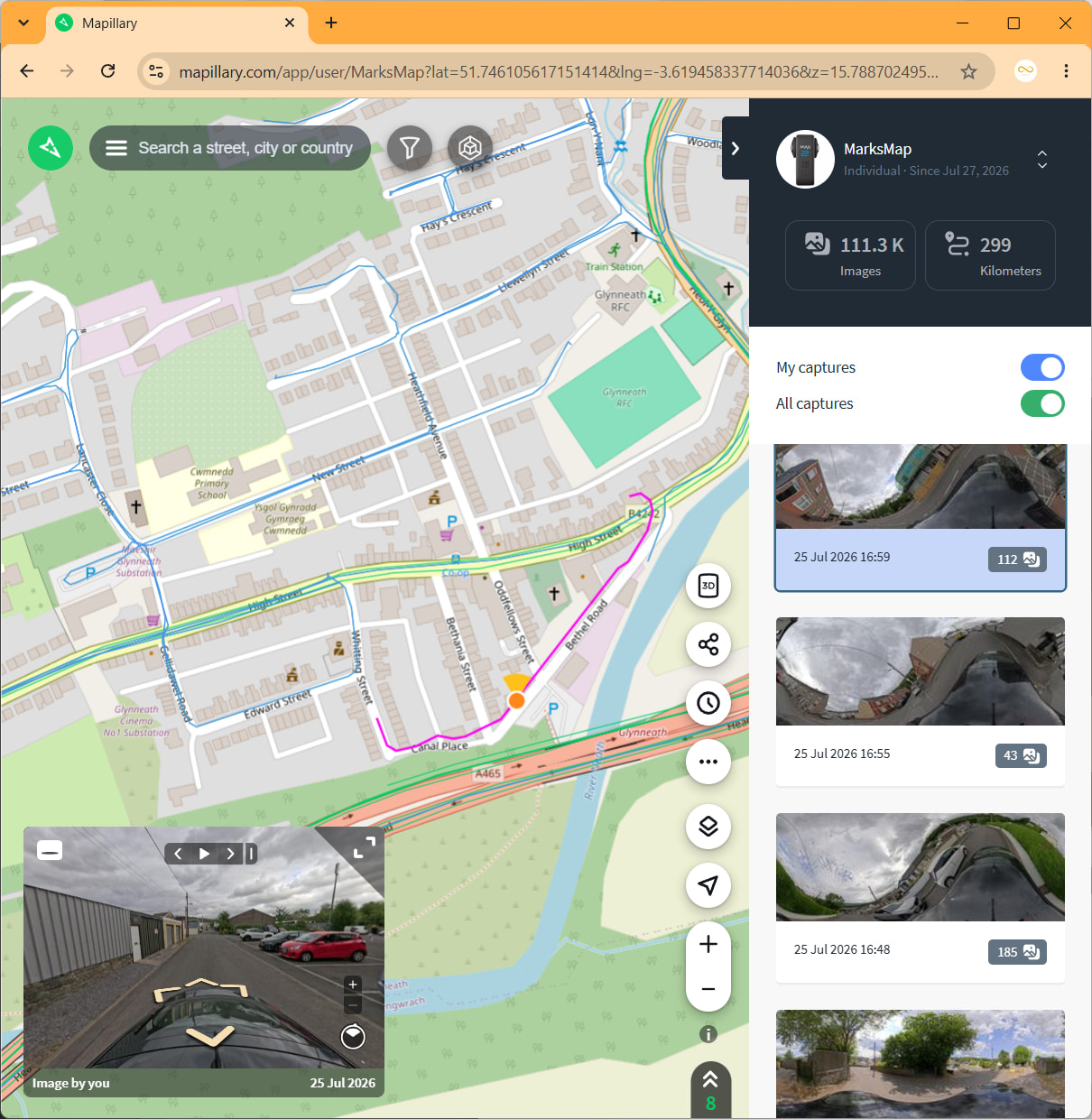
A route captured Yesterday uploaded 6 or 7 hours ago is NOT showing on Android App, BUT IS showing on Chrome browser (PC & phone), BUT IS not BLUE (My captures), it is GREEN (All captures).

The capture clip is showing :green_circle:Image ingestion :green_circle:Map data processing :yellow_circle: Map update.

Why does the Android app not show the route (it’s great is available so quick on a browser)? When out capturing the Android version is more useful to me than the windows/phone browser.

I am not uploading straight away but within 24 hours (which is very slow and occasionally fails). So far I have been revisiting the area I covered to add missed bits/recapture noisey GPS and move onto the next area from my captured boundary. Having the APP map remind me what I have covered would be great, especially areas I am not familiar with myself already.

Next question is probably not Mapillary directly an issue and maybe an external app could be suggested to solve my issue. Is there an App that records my route on a map so I know before Mapillary is even sent the captures where I have covered. I got lost going round some housing estates trying to get every road, but most roads look the same and I captured the same areas a few times thinking it was a new area.

In an ideal world it would be nice if Mapillary recorded your route in perhaps white which disappears in 7 days to give time for uploads, turns yellow when Ingestion before turning blue for my captures once Map Updated.

It would also highlight if I have a capture which I have missed uploading.

The “My Captures” clip list would be great if they included the filename. I have every capture still but I know some failed possibly during my PC crashing or a windows untimely update. I don’t know which files were unsuccessful and as .360 files not easy to know what it contains, I know Uploader will eventually plot the route for each file, but normally I need it to be uploading my latest batch than trying to work out which file is missing from the previous batch.

1 Like

OsmAnd

Hi @MarksMap, thank you for the report. Could you please share a bit more details on this one?

Do you mean that you don’t see the capture in your feed on Android?

In general, the feed in the app is the same as the feed in the browser. I think they use exactly the same query. Just to cross-out the easy case, is there a chance you had no internet (poor coverage) connection and the app just used the cached feed?

@Anders maybe you have you seen any cases like this?
__
BR, Yaro

Never seen this behavior. Pull-to-refresh should be enough. If it happens again, try killing the app and launching it again.

1 Like

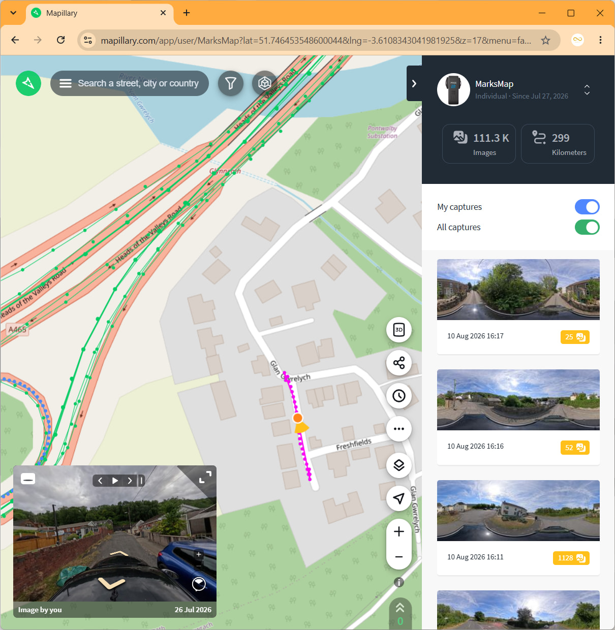
Here is my view on Chrome Windows Browser of a 26 July capture https://www.mapillary.com/app/user/MarksMap?lat=51.746453548600044&lng=-3.6108343041981925&z=17&menu=false&mapStyle=OpenStreetMap&pKey=1679096923387508&x=0.23609248649660497&y=0.7883168011279043&zoom=0

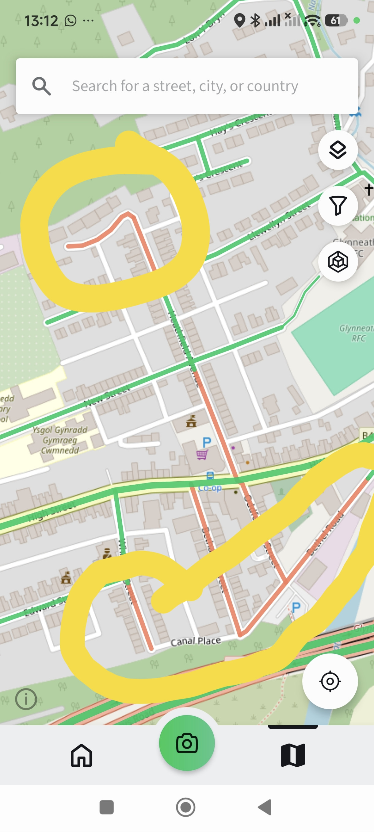
and my Android 2026.08.06-6.14.0 app (after killing app, reloading,(couldn’t work out pull down to refresh as it just moves the map for me))

It’s frustrating as the Max2 sometimes decides to stop recording without ANY notification/sound from app (probably can not hear the camera). I just glance at the GoPro app and it has stopped recording; it has also changed from Video to Photo on a couple of occasions, which isn’t obvious until I have taken 4 photos trying to start it again. I guess it has overheated but allows recording again within seconds.

At the moment, all my recordings are very local, so can be revisited but I can’t trust the APP to find gaps. Every time I’ve noticed the issue is while at home with Wifi that is serving the PC version, it maybe the cache being the problem, but reopening the app doesn’t solve it.

Thanks for your attempts to troubleshoot it.

Just noticed that my captures are from BEFORE I created the account (Day before), also the green lines on the Android app are captured AFTER the 26 July capture - So I think rules out cache issue. The remaining blank real roads (with street names in the picture) I believe I’ve captured them at least a couple of times since, although can’t be certain everything was working (GoPro recording, not noisey etc), I will capture them all again and make a point of monitoring them.

Ah ok, now I understand.

You have selected two different map layers. The first screenshot has the layer “All captures” selected, which shows captures by you and everyone else, and it shows the raw capture so it will be available faster on the map (both on the web and on mobile).

In the mobile app, you have selected “Captures needed”. It shows map-matched captures, which require full processing, which takes some time. Where it’s red, it means “not captured”.

In your example, the captures are still being processed. If you look at your feed in the first screenshot, the captures have a yellow symbol, which means the captures are still being processed. You can hover with your mouse pointer to get more details.

The pull-to-refresh was regarding the feed on the homepage, not on the map, apologies for the confusion!

1 Like

Thanks Anders, the capture was grey. It was over two weeks after upload. The yellow captures on my side panel screenshot are from more recent <48hr captures. (See the date differences in the datestamp.)

I still think it’s a bug because they were taken the day before I joined Mapillary as they were filmed specifically for Google Streetview that were missing from their content. I added them as the first few clips BEFORE creating 360 content for 2D and undiscovered areas of the Mapillary data.

On the different layers, surely I want to look at everyone’s content to see 360s captured by anyone else (although there is not much at all locally, most existing content is just dashcam footage). Still today, 19 days after upload it’s still showing as Captures Needed.

Hi @MarksMap, I’ve checked the areas. They have better coverage now (so it looks like tiling was just lagging behind).

and here

I have discovered a few sequences that didn’t match. Sometimes that happens due to various reasons. We are improving this in parallel and, what is important, we re-map matched everything at least once a month to clean tails/oddities after our improvements.

__
BR, Yaro

Thanks Yaro,

Happy to close down the issue, but the bug is still there. The first image you have supplied is very similar to the Street map version, so I filled in the bottom left road for Google. I used that same tiny segment for Mapillary the day after, that has not been shown blue yet on the Captures Needed map.

I revisited the site 15 days after an filmed in 360 the areas Streetview had visited but Mapillary hadn’t. So the 3/4 of the original “Captures Needed” road has been visited twice, the second shorter length Mapillary shows as “Best Captures” the 26 July is visible without logging in but is not marked as captured.

The angle of the camera was at a slight 15° degree that I thought maybe fixed automatically by the camera or uploader, but it’s the same angle as my first week of uploads that all after the 27th July are accepted as “Best captures”. I’ve now made sure the camera is directly vertical (a lot less stable if you were watching the full video, but not noticible with the large 5m jumps).

So as the issue hasn’t really been repeated for the newer captures, and I’ve revisited most of the 26th July route I think it can be just put down to the bug of captures taken before the user sign-up date.