We just submitted the latest beta versions of the mobile apps and we would appreciate your feedback before we release the update to everyone. The builds should be available shortly.
iOS: Join TestFlight
Android: Join Open testing
The web update is planned to be published early next week.
The web update is now also live: https://www.mapillary.com/app/
Introducing a new map layer: Captures!

We’re excited to introduce a brand-new map layer! We want to allow you to better visualize your data, making it easier than ever to pinpoint your street coverage.
In the Map layers menu, you’ll find an updated Captures section that lets you toggle between exactly what you need to see:
- All captures: access the raw sequence data you’re used to
- Best captures: view optimized, map-matched captures
- Captures needed: know exactly where to go next with a view that highlights missing coverage
New map layer “Best captures”


“All captures” to the left, “Best captures” to the right
Instead of seeing all the raw captures, the new layer “Best captures” cleans up the map by matching the captures to the streets on the map.
The new layer also makes it easier to find the best captures. When you tap on the map, we open the capture with the highest quality score. For instance, a 360 or a recent image gets a higher score, a blurry or an image captured at night gets a lower score.
New map layer “Captures needed”

The “Captures needed” layer is the same as the map-matched “Best captures” layer, with the addition of highlighting streets in red that are missing coverage. This is helpful when planning where to capture.
Map filters
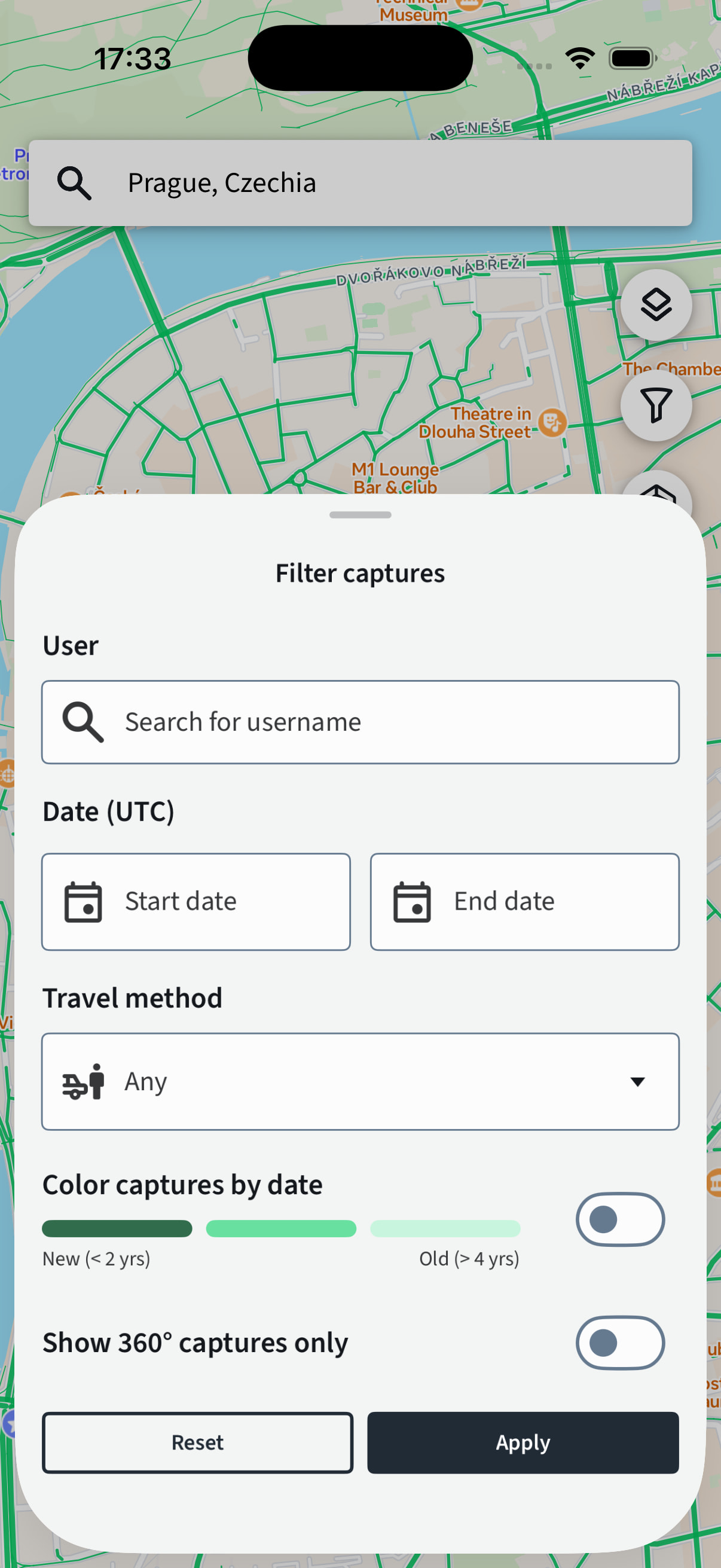
Just like on the web today, you can now apply filters to the map in the mobile apps. You can filter by user, date (from/to), travel method (all, on foot, vehicle), and 360 only. All of these filters can be combined.
Map data


Showing “No entry” traffic signs
Similar to map filters, you can now also show map data in the mobile apps. Just like on the web, we support traffic signs (stop signs etc) and point features (benches, CCTVs etc).
Camera map updates

Showing “Captures needed” during capture
The new map features are also available during capture. The “Capture needed” layer is especially useful here to show where to capture.
Looking forward to your feedback
The new map capture styles will continue to improve over time. Building a universal solution that works across all captures and regions worldwide is inherently challenging, so they may not be perfect in every scenario. We welcome your feedback—whether it’s ideas for improvements or bug reports!
Update: Android is live 
Update 2: iOS is live
Update 3: Web is live

 .
. Great improvements and updates! Yey!
 I could even imagine a dynamic time period based on type of way and the amount of redundant coverage.
 for non-mobile app users to also get like beta access to these new features in the web app. You could host it on something like
  This is even better than I thought! I am unable to test the Maps 2.0 update, hence my lengthy elaboration. We will have to see how other Mapillary users react to it, though I think you are moving in the right direction. Eventually, highlighting coverage gaps and outdated coverage can be folded into one problem or map layer. Anyway, thank you everybody who worked on this major update!