What does this number mean?
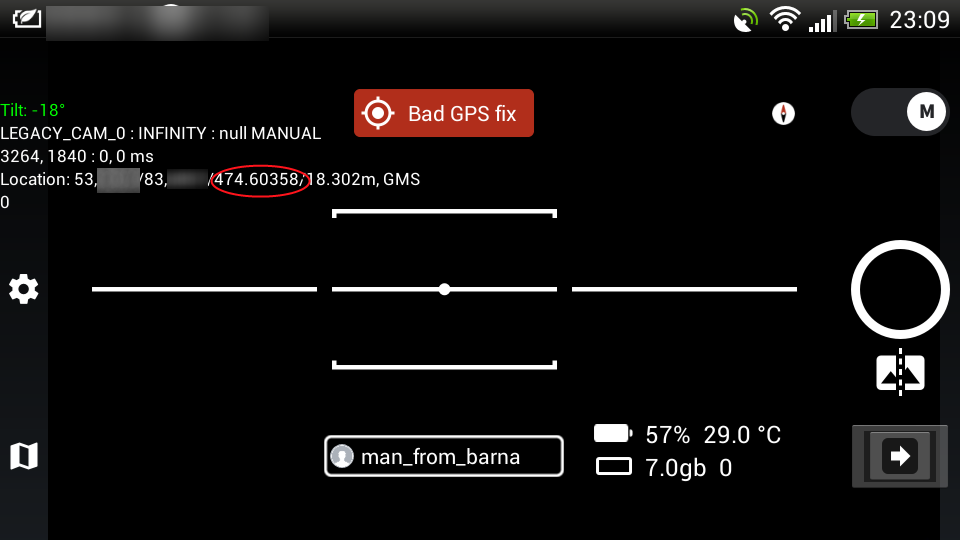
Could it be your altitude?
1 Like
Unfortunately no. The number changes to negative. We have nothing below sea level, that’s why I’m interested.

Do you know the GPS chip in your device? Manufacturer may have some specs on the nmea sentence that it produces.
Did not recognize, unknown. I think the mapillari team should know this.
I have access to 5 different smartphones …
Height of geoid above WGS84 ellipsoid?
1 Like
Perhaps, but I still do not understand. I forgot to say that a number can change polarity with lightning speed (+ or -).
See your links …
I am on IOS but if you are on Android then grab something like this as it will dispaly a variety of nmea sentences but at least at the start of the line you can see which sentence. Then you can look at those other pages and figure out which sentence (or parts thereof) might be being used by the mapillary application and what the specific parts mean (maybe…).
1 Like
This value is representing the compass heading
A compass angle over 400? and a negative value…?
Beam me up Scotty ![]()
Please send us the logs to check what’s wrong. As there is definitely something wrong with this value.
Ok, send later
mapillary trace.txt- This is it? Its weight is 342 megabytes.
yes this is it. wow that’s a lot.
Can you please save this file and then: clear logs, try to reproduce the problem and send me the new generated file that will be a lot smaller in size.
Hello! I can not send you a text file through the forum (invalid format). Now it weighs 12 megabytes. Where to send?
Can you send this to logs@mapillary.com or support@mapillary.com?
Thanks!